As Florida reels from Hurricane Ian, the US flood insurance program receives a brief reprieve
RIMS has welcomed the extension of the National Flood Insurance Program (NFIP) until 16 December 2022.
The reauthorised NFIP bill provides critical financial support to coastal properties, as well as many commercial and residential properties located in flood zones across the US.
The extension not only allows these properties to remain financially protected, it also enables them to remain compliant with strictly enforced insurance mandates found in real estate contracts.
“Since 2018, every single US State has experienced a flood emergency,” said RIMS President Patrick Sterling. “Risk professionals count on the National Flood Insurance Program to protect our organisations’ assets and to remain in good standing with our commercial real estate contracts.
“RIMS is encouraged by this bi-partisan effort and will continue to work with our partners on Capitol Hill to support the development of a longer-term extension in December.”
“The extension of the NFIP is a shining example of the value of RIMS advocacy,” said RIMS CEO Gary LaBranche.
“Risk professionals from across the US met at RIMS Legislative Summit and effectively voiced their concerns and priorities to their representatives. Working together, the RIMS community can impact change and empower risk leaders to help make the world safer, more secure, and more sustainable.”
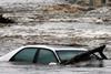
Ian brings widespread flooding
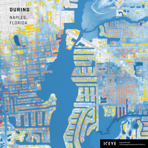
Meanwhile, Floridians have been surveying the devastation brought by Hurricane Ian and its 8 foot storm surge.
According to earth observation firm ICEYE, 84,000 properties in the Sunshine State were affected by flood levels of 2ft or more when the category 4 windstorm made landfall.
Of those, 11,132 properties were impacted by a wall of water between 5 and 8ft, and 2,231 properties were hit by surges of 8ft or more. According to reports, some properties were washed away completely.
ICEYE owns and operates the world’s largest SAR satellite constellation. By combining high-resolution satellite imagery with auxiliary information sources, the company generates unique flood observation data in near real-time, including accurate flood extent footprints and detailed flood depth measurements at the individual building level.


No comments yet